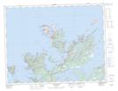
Maps showing Fairbanks East, Twillingate, Newfoundland and Labrador
Fairbanks East is a Unincorporated area located in Twillingate, Newfoundland and Labrador and has an elevation of 12 meters.
- Latitude: 49° 33' 14'' North (decimal: 49.5538888)
- Longitude: 54° 44' 39'' West (decimal: -54.7441666)
- Topography Feature Category: Unincorporated area
- Geographical Feature: Neighbourhood
- Canadian Province/Territory: Newfoundland and Labrador
- Elevation: 12 meters
- Location: Twillingate
- Atlas of Canada Locator Map: Fairbanks East
- GPS Coordinate Locator Map: Fairbanks East Lat/Long
Fairbanks East NTS Map Sheets