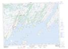
Maps showing Boat Harbour West, Newfoundland and Labrador
Boat Harbour West is a Unincorporated area located in Newfoundland and Labrador.
- Latitude: 47° 25' 48'' North (decimal: 47.4299999)
- Longitude: 54° 50' 33'' West (decimal: -54.8424999)
- Topography Feature Category: Unincorporated area
- Geographical Feature: Locality
- Canadian Province/Territory: Newfoundland and Labrador
- Atlas of Canada Locator Map: Boat Harbour West
- GPS Coordinate Locator Map: Boat Harbour West Lat/Long
Boat Harbour West NTS Map Sheets