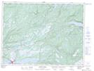
Maps showing Black Duck Siding, Newfoundland and Labrador
Black Duck Siding is a Unincorporated area located in Newfoundland and Labrador.
- Latitude: 48° 34' 51'' North (decimal: 48.5808333)
- Longitude: 58° 23' 5'' West (decimal: -58.3847222)
- Topography Feature Category: Unincorporated area
- Geographical Feature: Locality
- Canadian Province/Territory: Newfoundland and Labrador
- Atlas of Canada Locator Map: Black Duck Siding
- GPS Coordinate Locator Map: Black Duck Siding Lat/Long
Black Duck Siding NTS Map Sheets