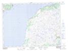
Maps showing St. Jacques Shoal, Newfoundland and Labrador
St. Jacques Shoal is a Shoal located in Newfoundland and Labrador.
- Latitude: 47° 28' 43'' North (decimal: 47.4786111)
- Longitude: 55° 23' 25'' West (decimal: -55.3902777)
- Topography Feature Category: Shoal
- Geographical Feature: Shoal
- Canadian Province/Territory: Newfoundland and Labrador
- Atlas of Canada Locator Map: St. Jacques Shoal
- GPS Coordinate Locator Map: St. Jacques Shoal Lat/Long
St. Jacques Shoal NTS Map Sheets