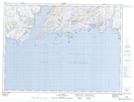
Maps showing Colombier Shoal, Newfoundland and Labrador
Colombier Shoal is a Shoal located in Newfoundland and Labrador.
- Latitude: 47° 38' 20'' North (decimal: 47.6388688)
- Longitude: 58° 1' 19'' West (decimal: -58.0219161)
- Topography Feature Category: Shoal
- Geographical Feature: Shoal
- Canadian Province/Territory: Newfoundland and Labrador
- Atlas of Canada Locator Map: Colombier Shoal
- GPS Coordinate Locator Map: Colombier Shoal Lat/Long
Colombier Shoal NTS Map Sheets