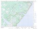
Maps showing The Middle Ground, Newfoundland and Labrador
The Middle Ground is a Shoal located in Newfoundland and Labrador.
- Latitude: 50° 13' 55'' North (decimal: 50.2319444)
- Longitude: 56° 30' 13'' West (decimal: -56.5036111)
- Topography Feature Category: Shoal
- Geographical Feature: Ground
- Canadian Province/Territory: Newfoundland and Labrador
- Atlas of Canada Locator Map: The Middle Ground
- GPS Coordinate Locator Map: The Middle Ground Lat/Long
The Middle Ground NTS Map Sheets