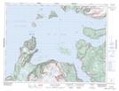
Maps showing Little Port, Newfoundland and Labrador
Little Port is a Unincorporated area located in Newfoundland and Labrador.
- Latitude: 49° 6' 25'' North (decimal: 49.1069000)
- Longitude: 58° 25' 7'' West (decimal: -58.4186000)
- Topography Feature Category: Unincorporated area
- Geographical Feature: Neighbourhood
- Canadian Province/Territory: Newfoundland and Labrador
- Atlas of Canada Locator Map: Little Port
- GPS Coordinate Locator Map: Little Port Lat/Long
Little Port NTS Map Sheets