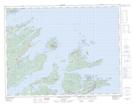
Maps showing Jim Rowsell Ground, Newfoundland and Labrador
Jim Rowsell Ground is a Shoal located in Newfoundland and Labrador.
- Latitude: 49° 38' 17'' North (decimal: 49.6380375)
- Longitude: 55° 39' 3'' West (decimal: -55.65075)
- Topography Feature Category: Shoal
- Geographical Feature: Ground
- Canadian Province/Territory: Newfoundland and Labrador
- Atlas of Canada Locator Map: Jim Rowsell Ground
- GPS Coordinate Locator Map: Jim Rowsell Ground Lat/Long
Jim Rowsell Ground NTS Map Sheets