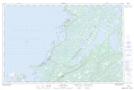
Maps showing Anchor Ledge, Newfoundland and Labrador
Anchor Ledge is a Shoal located in Newfoundland and Labrador.
- Latitude: 51° 13' 49'' North (decimal: 51.2302777)
- Longitude: 56° 48' 30'' West (decimal: -56.8083333)
- Topography Feature Category: Shoal
- Geographical Feature: Ledge
- Canadian Province/Territory: Newfoundland and Labrador
- Atlas of Canada Locator Map: Anchor Ledge
- GPS Coordinate Locator Map: Anchor Ledge Lat/Long
Anchor Ledge NTS Map Sheets