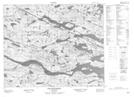
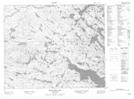
Maps showing Charlottetown, Eagle River, Newfoundland and Labrador
Charlottetown is a Town located in Eagle River, Newfoundland and Labrador and has an elevation of 21 meters.
- Latitude: 52° 45' 57'' North (decimal: 52.7657222)
- Longitude: 56° 8' 43'' West (decimal: -56.1452999)
- Topography Feature Category: Town
- Geographical Feature: Town
- Canadian Province/Territory: Newfoundland and Labrador
- Elevation: 21 meters
- Location: Eagle River
- Atlas of Canada Locator Map: Charlottetown
- GPS Coordinate Locator Map: Charlottetown Lat/Long
Charlottetown NTS Map Sheets