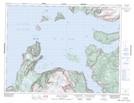
Maps showing York Harbour, Newfoundland and Labrador
York Harbour is a Town located in Newfoundland and Labrador and has an elevation of 33 meters.
- Latitude: 49° 3' 39'' North (decimal: 49.0609222)
- Longitude: 58° 19' 46'' West (decimal: -58.3295722)
- Topography Feature Category: Town
- Geographical Feature: Town
- Canadian Province/Territory: Newfoundland and Labrador
- Elevation: 33 meters
- Atlas of Canada Locator Map: York Harbour
- GPS Coordinate Locator Map: York Harbour Lat/Long
York Harbour NTS Map Sheets