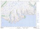
Maps showing Battery Point, Newfoundland and Labrador
Battery Point is a Cape located in Newfoundland and Labrador and has an elevation of 65 meters.
- Latitude: 47° 32' 46'' North (decimal: 47.5461111)
- Longitude: 56° 50' 23'' West (decimal: -56.8397222)
- Topography Feature Category: Cape
- Geographical Feature: Point
- Canadian Province/Territory: Newfoundland and Labrador
- Elevation: 65 meters
- Atlas of Canada Locator Map: Battery Point
- GPS Coordinate Locator Map: Battery Point Lat/Long
Battery Point NTS Map Sheets