Maps showing Brandies Rock, Newfoundland and Labrador
Brandies Rock is a Shoal located in Newfoundland and Labrador.
- Latitude: 47° 37' 14'' North (decimal: 47.6204888)
- Longitude: 59° 19' 31'' West (decimal: -59.3252736)
- Topography Feature Category: Shoal
- Geographical Feature: Rock
- Canadian Province/Territory: Newfoundland and Labrador
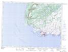
- Atlas of Canada Locator Map: Brandies Rock
- GPS Coordinate Locator Map: Brandies Rock Lat/Long
Brandies Rock NTS Map Sheets