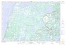
Maps showing Bateau Barrens, Newfoundland and Labrador
Bateau Barrens is a Low vegetation located in Newfoundland and Labrador and has an elevation of 40 meters.
- Latitude: 50° 25' 26'' North (decimal: 50.4238888)
- Longitude: 57° 27' 29'' West (decimal: -57.4580555)
- Topography Feature Category: Low vegetation
- Geographical Feature: Barrens
- Canadian Province/Territory: Newfoundland and Labrador
- Elevation: 40 meters
- Atlas of Canada Locator Map: Bateau Barrens
- GPS Coordinate Locator Map: Bateau Barrens Lat/Long
Bateau Barrens NTS Map Sheets