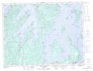
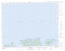
Maps showing Cull Island, Newfoundland and Labrador
Cull Island is a Unincorporated area located in Newfoundland and Labrador.
- Latitude: 49° 29' 3'' North (decimal: 49.4841666)
- Longitude: 55° 25' 22'' West (decimal: -55.4227777)
- Topography Feature Category: Unincorporated area
- Geographical Feature: Settlement
- Canadian Province/Territory: Newfoundland and Labrador
- GPS Coordinate Locator Map: Cull Island Lat/Long
Cull Island NTS Map Sheets