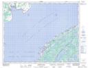
Maps showing Flower's Island, Newfoundland and Labrador
Flower's Island is a Island located in Newfoundland and Labrador.
- Latitude: 51° 18' 00'' North (decimal: 51.2999999)
- Longitude: 56° 44' 57'' West (decimal: -56.7491666)
- Topography Feature Category: Island
- Geographical Feature: Island
- Canadian Province/Territory: Newfoundland and Labrador
- GPS Coordinate Locator Map: Flower's Island Lat/Long
Flower's Island NTS Map Sheets