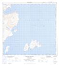
Maps showing Gull Cliff, Newfoundland and Labrador
Gull Cliff is a Cliff located in Newfoundland and Labrador.
- Latitude: 58° 33' 13'' North (decimal: 58.5535691)
- Longitude: 62° 37' 56'' West (decimal: -62.6321094)
- Topography Feature Category: Cliff
- Geographical Feature: Cliff
- Canadian Province/Territory: Newfoundland and Labrador
- Atlas of Canada Locator Map: Gull Cliff
- GPS Coordinate Locator Map: Gull Cliff Lat/Long
Gull Cliff NTS Map Sheets