Canada Topographic Maps

Long Point Topo Maps

Topography maps and Latitude/Longitude Location

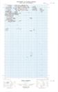
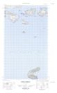
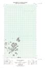
Maps showing Long Point, Newfoundland and Labrador

Long Point is a Cape located in Newfoundland and Labrador.

  • Latitude: 54° 29' 57'' North   (decimal: 54.4992494)
  • Longitude: 57° 11' 18'' West   (decimal: -57.1883694)
  • Topography Feature Category: Cape
  • Geographical Feature: Point
  • Canadian Province/Territory: Newfoundland and Labrador
  • Atlas of Canada Locator Map: Long Point
  • GPS Coordinate Locator Map: Long Point Lat/Long

Long Point NTS Map Sheets

013I06E Indian Harbour Topographic Map at 1:50,000 scale

013I06W Indian Harbour Topographic Map at 1:50,000 scale

013I11E Holton Harbour Topographic Map at 1:50,000 scale

013I11W Holton Harbour Topographic Map at 1:50,000 scale

013I Groswater Bay Topographic Map at 1:250,000 scale

 
Buy Topographic Maps DVD
Newsletter Sign-up

Yes, I want to receive map store discounts.


Bookmark and Share