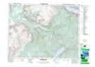
Maps showing Rope Cove Canyon, Newfoundland and Labrador
Rope Cove Canyon is a Valley located in Newfoundland and Labrador and has an elevation of 325 meters.
- Latitude: 48° 53' 26'' North (decimal: 48.8905555)
- Longitude: 58° 27' 52'' West (decimal: -58.4644444)
- Topography Feature Category: Valley
- Geographical Feature: Canyon
- Canadian Province/Territory: Newfoundland and Labrador
- Elevation: 325 meters
- Atlas of Canada Locator Map: Rope Cove Canyon
- GPS Coordinate Locator Map: Rope Cove Canyon Lat/Long
Rope Cove Canyon NTS Map Sheets