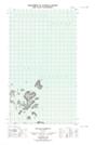
Maps showing Dark Tickle Harbour, Newfoundland and Labrador
Dark Tickle Harbour is a Bay located in Newfoundland and Labrador.
- Latitude: 54° 32' 7'' North (decimal: 54.5354053)
- Longitude: 57° 11' 52'' West (decimal: -57.1977170)
- Topography Feature Category: Bay
- Geographical Feature: Harbour
- Canadian Province/Territory: Newfoundland and Labrador
- Atlas of Canada Locator Map: Dark Tickle Harbour
- GPS Coordinate Locator Map: Dark Tickle Harbour Lat/Long
Dark Tickle Harbour NTS Map Sheets