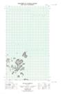
Maps showing Butt Island, Newfoundland and Labrador
Butt Island is a Island located in Newfoundland and Labrador.
- Latitude: 54° 32' 31'' North (decimal: 54.5419402)
- Longitude: 57° 12' 39'' West (decimal: -57.2107426)
- Topography Feature Category: Island
- Geographical Feature: Island
- Canadian Province/Territory: Newfoundland and Labrador
- Atlas of Canada Locator Map: Butt Island
- GPS Coordinate Locator Map: Butt Island Lat/Long
Butt Island NTS Map Sheets