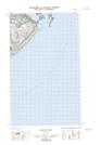
Maps showing York Point, Newfoundland and Labrador
York Point is a Cape located in Newfoundland and Labrador and has an elevation of 3 meters.
- Latitude: 51° 57' 48'' North (decimal: 51.9632019)
- Longitude: 55° 53' 24'' West (decimal: -55.8900960)
- Topography Feature Category: Cape
- Geographical Feature: Point
- Canadian Province/Territory: Newfoundland and Labrador
- Elevation: 3 meters
- Atlas of Canada Locator Map: York Point
- GPS Coordinate Locator Map: York Point Lat/Long
York Point NTS Map Sheets