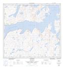
Maps showing Tiheratsuk Inlet, Newfoundland and Labrador
Tiheratsuk Inlet is a Bay located in Newfoundland and Labrador.
- Latitude: 58° 14' 14'' North (decimal: 58.2373153)
- Longitude: 62° 38' 28'' West (decimal: -62.6410111)
- Topography Feature Category: Bay
- Geographical Feature: Inlet
- Canadian Province/Territory: Newfoundland and Labrador
- Atlas of Canada Locator Map: Tiheratsuk Inlet
- GPS Coordinate Locator Map: Tiheratsuk Inlet Lat/Long