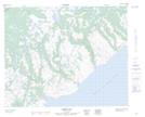
Maps showing Seal Rocks, Newfoundland and Labrador
Seal Rocks is a Shoal located in Newfoundland and Labrador.
- Latitude: 51° 46' 29'' North (decimal: 51.7747491)
- Longitude: 56° 15' 37'' West (decimal: -56.2603250)
- Topography Feature Category: Shoal
- Geographical Feature: Rocks
- Canadian Province/Territory: Newfoundland and Labrador
- Atlas of Canada Locator Map: Seal Rocks
- GPS Coordinate Locator Map: Seal Rocks Lat/Long
Seal Rocks NTS Map Sheets