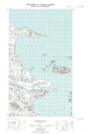
Maps showing Huntingdon Flats, Newfoundland and Labrador
Huntingdon Flats is a Beach located in Newfoundland and Labrador.
- Latitude: 53° 45' 30'' North (decimal: 53.7584399)
- Longitude: 57° 1' 57'' West (decimal: -57.0325277)
- Topography Feature Category: Beach
- Geographical Feature: Flats
- Canadian Province/Territory: Newfoundland and Labrador
- Atlas of Canada Locator Map: Huntingdon Flats
- GPS Coordinate Locator Map: Huntingdon Flats Lat/Long
Huntingdon Flats NTS Map Sheets