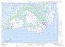
Maps showing St. Lunaire Peak, Newfoundland and Labrador
St. Lunaire Peak is a Mountain located in Newfoundland and Labrador and has an elevation of 48 meters.
- Latitude: 51° 27' 46'' North (decimal: 51.4627777)
- Longitude: 55° 30' 56'' West (decimal: -55.5155555)
- Topography Feature Category: Mountain
- Geographical Feature: Peak
- Canadian Province/Territory: Newfoundland and Labrador
- Elevation: 48 meters
- Atlas of Canada Locator Map: St. Lunaire Peak
- GPS Coordinate Locator Map: St. Lunaire Peak Lat/Long
St. Lunaire Peak NTS Map Sheets