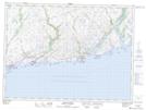
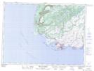
Maps showing Southeast Point, Newfoundland and Labrador
Southeast Point is a Cape located in Newfoundland and Labrador.
- Latitude: 47° 34' 1'' North (decimal: 47.5669444)
- Longitude: 58° 59' 57'' West (decimal: -58.9991666)
- Topography Feature Category: Cape
- Geographical Feature: Point
- Canadian Province/Territory: Newfoundland and Labrador
- Atlas of Canada Locator Map: Southeast Point
- GPS Coordinate Locator Map: Southeast Point Lat/Long
Southeast Point NTS Map Sheets