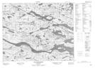
Maps showing Nevile Island, Newfoundland and Labrador
Nevile Island is a Island located in Newfoundland and Labrador.
- Latitude: 52° 33' 12'' North (decimal: 52.5533333)
- Longitude: 56° 5' 55'' West (decimal: -56.0986111)
- Topography Feature Category: Island
- Geographical Feature: Island
- Canadian Province/Territory: Newfoundland and Labrador
- Atlas of Canada Locator Map: Nevile Island
- GPS Coordinate Locator Map: Nevile Island Lat/Long
Nevile Island NTS Map Sheets