Maps showing Graley Rock, Newfoundland and Labrador
Graley Rock is a Shoal located in Newfoundland and Labrador.
- Latitude: 47° 34' 23'' North (decimal: 47.5730527)
- Longitude: 57° 42' 20'' West (decimal: -57.7055758)
- Topography Feature Category: Shoal
- Geographical Feature: Rock
- Canadian Province/Territory: Newfoundland and Labrador
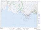
- Atlas of Canada Locator Map: Graley Rock
- GPS Coordinate Locator Map: Graley Rock Lat/Long