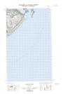
Maps showing Henley Harbour, Eagle River, Newfoundland and Labrador
Henley Harbour is a Bay located in Eagle River, Newfoundland and Labrador.
- Latitude: 51° 59' 34'' North (decimal: 51.9927966)
- Longitude: 55° 51' 11'' West (decimal: -55.8529419)
- Topography Feature Category: Bay
- Geographical Feature: Harbour
- Canadian Province/Territory: Newfoundland and Labrador
- Location: Eagle River
- Atlas of Canada Locator Map: Henley Harbour
- GPS Coordinate Locator Map: Henley Harbour Lat/Long
Henley Harbour NTS Map Sheets