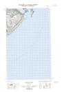
Maps showing Henney Shoal, Newfoundland and Labrador
Henney Shoal is a Shoal located in Newfoundland and Labrador.
- Latitude: 51° 59' 52'' North (decimal: 51.9979101)
- Longitude: 55° 49' 56'' West (decimal: -55.8323242)
- Topography Feature Category: Shoal
- Geographical Feature: Shoal
- Canadian Province/Territory: Newfoundland and Labrador
- Atlas of Canada Locator Map: Henney Shoal
- GPS Coordinate Locator Map: Henney Shoal Lat/Long
Henney Shoal NTS Map Sheets