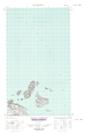
Maps showing High-rat Bank, Newfoundland and Labrador
High-rat Bank is a Shoal located in Newfoundland and Labrador.
- Latitude: 53° 49' 4'' North (decimal: 53.8177854)
- Longitude: 56° 28' 6'' West (decimal: -56.4683991)
- Topography Feature Category: Shoal
- Geographical Feature: Bank
- Canadian Province/Territory: Newfoundland and Labrador
- Atlas of Canada Locator Map: High-rat Bank
- GPS Coordinate Locator Map: High-rat Bank Lat/Long
High-rat Bank NTS Map Sheets