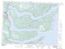
Maps showing Heartsease Ledge, Newfoundland and Labrador
Heartsease Ledge is a Shoal located in Newfoundland and Labrador.
- Latitude: 48° 2' 51'' North (decimal: 48.0475000)
- Longitude: 53° 35' 31'' West (decimal: -53.5919444)
- Topography Feature Category: Shoal
- Geographical Feature: Ledge
- Canadian Province/Territory: Newfoundland and Labrador
- Atlas of Canada Locator Map: Heartsease Ledge
- GPS Coordinate Locator Map: Heartsease Ledge Lat/Long
Heartsease Ledge NTS Map Sheets