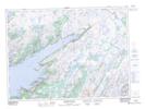
Maps showing Hares Ears Shoal, Newfoundland and Labrador
Hares Ears Shoal is a Shoal located in Newfoundland and Labrador.
- Latitude: 47° 30' 27'' North (decimal: 47.5075000)
- Longitude: 54° 59' 22'' West (decimal: -54.9894444)
- Topography Feature Category: Shoal
- Geographical Feature: Shoal
- Canadian Province/Territory: Newfoundland and Labrador
- Atlas of Canada Locator Map: Hares Ears Shoal
- GPS Coordinate Locator Map: Hares Ears Shoal Lat/Long
Hares Ears Shoal NTS Map Sheets