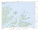
Maps showing Foggy Ledge, Newfoundland and Labrador
Foggy Ledge is a Shoal located in Newfoundland and Labrador.
- Latitude: 49° 39' 00'' North (decimal: 49.6499727)
- Longitude: 55° 38' 9'' West (decimal: -55.6357272)
- Topography Feature Category: Shoal
- Geographical Feature: Ledge
- Canadian Province/Territory: Newfoundland and Labrador
- Atlas of Canada Locator Map: Foggy Ledge
- GPS Coordinate Locator Map: Foggy Ledge Lat/Long
Foggy Ledge NTS Map Sheets