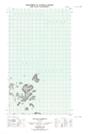
Maps showing Harbour Rock, Newfoundland and Labrador
Harbour Rock is a Shoal located in Newfoundland and Labrador.
- Latitude: 54° 34' 56'' North (decimal: 54.5823221)
- Longitude: 57° 16' 37'' West (decimal: -57.2769864)
- Topography Feature Category: Shoal
- Geographical Feature: Rock
- Canadian Province/Territory: Newfoundland and Labrador
- Atlas of Canada Locator Map: Harbour Rock
- GPS Coordinate Locator Map: Harbour Rock Lat/Long
Harbour Rock NTS Map Sheets