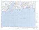
Maps showing Lance Spot, Newfoundland and Labrador
Lance Spot is a Shoal located in Newfoundland and Labrador.
- Latitude: 47° 39' 29'' North (decimal: 47.6580025)
- Longitude: 58° 6' 11'' West (decimal: -58.1031702)
- Topography Feature Category: Shoal
- Geographical Feature: Spot
- Canadian Province/Territory: Newfoundland and Labrador
- Atlas of Canada Locator Map: Lance Spot
- GPS Coordinate Locator Map: Lance Spot Lat/Long
Lance Spot NTS Map Sheets