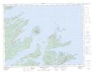
Maps showing Inner Harbour, Newfoundland and Labrador
Inner Harbour is a Bay located in Newfoundland and Labrador.
- Latitude: 49° 30' 19'' North (decimal: 49.5052776)
- Longitude: 55° 43' 57'' West (decimal: -55.7324998)
- Topography Feature Category: Bay
- Geographical Feature: Harbour
- Canadian Province/Territory: Newfoundland and Labrador
- Atlas of Canada Locator Map: Inner Harbour
- GPS Coordinate Locator Map: Inner Harbour Lat/Long
Inner Harbour NTS Map Sheets