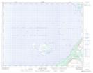
Maps showing Ellinor Shoals, Newfoundland and Labrador
Ellinor Shoals is a Shoal located in Newfoundland and Labrador.
- Latitude: 50° 45' 2'' North (decimal: 50.7505555)
- Longitude: 57° 16' 8'' West (decimal: -57.2688888)
- Topography Feature Category: Shoal
- Geographical Feature: Shoals
- Canadian Province/Territory: Newfoundland and Labrador
- Atlas of Canada Locator Map: Ellinor Shoals
- GPS Coordinate Locator Map: Ellinor Shoals Lat/Long
Ellinor Shoals NTS Map Sheets