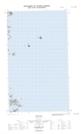
Maps showing Eastern Rock, Newfoundland and Labrador
Eastern Rock is a Shoal located in Newfoundland and Labrador.
- Latitude: 53° 19' 26'' North (decimal: 53.3238410)
- Longitude: 55° 42' 55'' West (decimal: -55.7152844)
- Topography Feature Category: Shoal
- Geographical Feature: Rock
- Canadian Province/Territory: Newfoundland and Labrador
- Atlas of Canada Locator Map: Eastern Rock
- GPS Coordinate Locator Map: Eastern Rock Lat/Long
Eastern Rock NTS Map Sheets
003E Map Not Available Topographic Map at 1:250,000 scale
