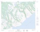
Maps showing East Point, Newfoundland and Labrador
East Point is a Cape located in Newfoundland and Labrador and has an elevation of 13 meters.
- Latitude: 51° 46' 17'' North (decimal: 51.7714775)
- Longitude: 56° 18' 14'' West (decimal: -56.3037610)
- Topography Feature Category: Cape
- Geographical Feature: Point
- Canadian Province/Territory: Newfoundland and Labrador
- Elevation: 13 meters
- Atlas of Canada Locator Map: East Point
- GPS Coordinate Locator Map: East Point Lat/Long
East Point NTS Map Sheets