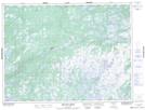
Maps showing Sculpin Hill, Windsor-Buchans, Newfoundland and Labrador
Sculpin Hill is a Mountain located in Windsor-Buchans, Newfoundland and Labrador and has an elevation of 231 meters.
- Latitude: 48° 38' 13'' North (decimal: 48.6369444)
- Longitude: 56° 18' 43'' West (decimal: -56.3119444)
- Topography Feature Category: Mountain
- Geographical Feature: Hill
- Canadian Province/Territory: Newfoundland and Labrador
- Elevation: 231 meters
- Location: Windsor-Buchans
- Atlas of Canada Locator Map: Sculpin Hill
- GPS Coordinate Locator Map: Sculpin Hill Lat/Long
Sculpin Hill NTS Map Sheets