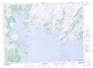
Maps showing Tickle Harbour, Newfoundland and Labrador
Tickle Harbour is a Bay located in Newfoundland and Labrador and has an elevation of 64 meters.
- Latitude: 47° 41' 11'' North (decimal: 47.6863888)
- Longitude: 55° 7' 26'' West (decimal: -55.1238888)
- Topography Feature Category: Bay
- Geographical Feature: Harbour
- Canadian Province/Territory: Newfoundland and Labrador
- Elevation: 64 meters
- Atlas of Canada Locator Map: Tickle Harbour
- GPS Coordinate Locator Map: Tickle Harbour Lat/Long
Tickle Harbour NTS Map Sheets