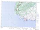
Maps showing The Tolt, Newfoundland and Labrador
The Tolt is a Mountain located in Newfoundland and Labrador and has an elevation of 192 meters.
- Latitude: 47° 42' 46'' North (decimal: 47.7127777)
- Longitude: 59° 16' 34'' West (decimal: -59.2761111)
- Topography Feature Category: Mountain
- Geographical Feature: Hill
- Canadian Province/Territory: Newfoundland and Labrador
- Elevation: 192 meters
- Atlas of Canada Locator Map: The Tolt
- GPS Coordinate Locator Map: The Tolt Lat/Long
The Tolt NTS Map Sheets