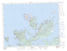
Maps showing Ragged Point, Newfoundland and Labrador
Ragged Point is a Cape located in Newfoundland and Labrador and has an elevation of 0 meters.
- Latitude: 49° 38' 3'' North (decimal: 49.6341666)
- Longitude: 54° 46' 20'' West (decimal: -54.7722222)
- Topography Feature Category: Cape
- Geographical Feature: Point
- Canadian Province/Territory: Newfoundland and Labrador
- Elevation: 0 meters
- Atlas of Canada Locator Map: Ragged Point
- GPS Coordinate Locator Map: Ragged Point Lat/Long
Ragged Point NTS Map Sheets