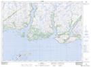
Maps showing Ramea Harbour, Newfoundland and Labrador
Ramea Harbour is a Bay located in Newfoundland and Labrador and has an elevation of 0 meters.
- Latitude: 47° 30' 31'' North (decimal: 47.5086111)
- Longitude: 57° 23' 27'' West (decimal: -57.3908333)
- Topography Feature Category: Bay
- Geographical Feature: Harbour
- Canadian Province/Territory: Newfoundland and Labrador
- Elevation: 0 meters
- Atlas of Canada Locator Map: Ramea Harbour
- GPS Coordinate Locator Map: Ramea Harbour Lat/Long