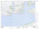
Maps showing Raymond Passage, Newfoundland and Labrador
Raymond Passage is a Channel located in Newfoundland and Labrador and has an elevation of 54 meters.
- Latitude: 47° 44' 10'' North (decimal: 47.7361111)
- Longitude: 56° 7' 8'' West (decimal: -56.1188888)
- Topography Feature Category: Channel
- Geographical Feature: Passage
- Canadian Province/Territory: Newfoundland and Labrador
- Elevation: 54 meters
- Atlas of Canada Locator Map: Raymond Passage
- GPS Coordinate Locator Map: Raymond Passage Lat/Long