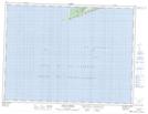
Maps showing Red Brook, Port au Port, Newfoundland and Labrador
Red Brook is a Unincorporated area located in Port au Port, Newfoundland and Labrador and has an elevation of 34 meters.
- Latitude: 48° 29' 30'' North (decimal: 48.4916666)
- Longitude: 59° 9' 35'' West (decimal: -59.1597222)
- Topography Feature Category: Unincorporated area
- Geographical Feature: Settlement
- Canadian Province/Territory: Newfoundland and Labrador
- Elevation: 34 meters
- Location: Port au Port
- Atlas of Canada Locator Map: Red Brook
- GPS Coordinate Locator Map: Red Brook Lat/Long
Red Brook NTS Map Sheets