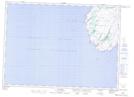
Maps showing The Neck, St. Mary's-The Capes, Newfoundland and Labrador
The Neck is a Low vegetation located in St. Mary's-The Capes, Newfoundland and Labrador and has an elevation of 115 meters.
- Latitude: 46° 41' 30'' North (decimal: 46.6916666)
- Longitude: 53° 32' 47'' West (decimal: -53.5463888)
- Topography Feature Category: Low vegetation
- Geographical Feature: Barrens
- Canadian Province/Territory: Newfoundland and Labrador
- Elevation: 115 meters
- Location: St. Mary's-The Capes
- Atlas of Canada Locator Map: The Neck
- GPS Coordinate Locator Map: The Neck Lat/Long
The Neck NTS Map Sheets