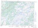
Maps showing Murphys Pond, Harbour Main-Bell Island, Newfoundland and Labrador
Murphys Pond is a Lake located in Harbour Main-Bell Island, Newfoundland and Labrador and has an elevation of 103 meters.
- Latitude: 47° 14' 56'' North (decimal: 47.2489000)
- Longitude: 53° 15' 27'' West (decimal: -53.2574999)
- Topography Feature Category: Lake
- Geographical Feature: Pond
- Canadian Province/Territory: Newfoundland and Labrador
- Elevation: 103 meters
- Location: Harbour Main-Bell Island
- Atlas of Canada Locator Map: Murphys Pond
- GPS Coordinate Locator Map: Murphys Pond Lat/Long
Murphys Pond NTS Map Sheets